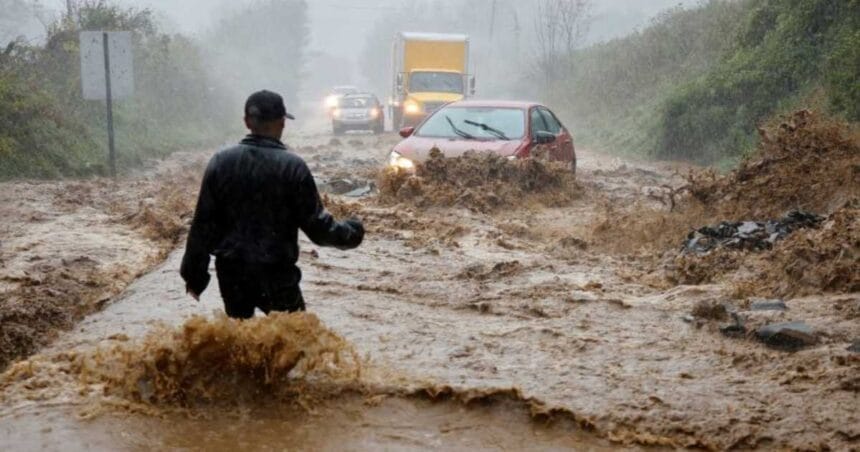
A stalled cold front coupled with lingering storms is triggering flash flood warnings across the Great Plains and Florida. Millions, especially in cities like Kansas City, Nashville, San Antonio, and Austin, face travel disruptions and urban flooding risks as flash flood alerts persist into the week.
Heavy Rainfall and Flood Alerts Issued
As the week continues, parts of the United States are under threat from heavy rainfall and flash flooding. The National Weather Service has placed several regions under flood watches, urging residents to stay alert for fast-changing conditions.
South Faces the Strongest Flood Threat
The greatest risk lies across the South including Louisiana, Mississippi, Arkansas, Alabama, Oklahoma, and eastern Texas where storms are producing several inches of rain in a short time. This has raised the potential for flash flooding in low-lying areas and along rivers.
Widespread Thunderstorms Continue
Thunderstorms stretch from the Gulf Coast through Texas and parts of the Plains. Warm and humid late-summer air is fueling the systems, giving them the ability to unleash heavy downpours quickly.
Millions Under Flood Risk
Meteorologists estimate that more than 15 million people remain under some level of flood risk. The storm system spans a wide area, with rainfall also reaching parts of the Ohio Valley and into the Northeast.
Flood Insurance Gap Adds to Concerns
Despite repeated flooding events across the country, only about 4% of U.S. homeowners have flood insurance. Experts warn this leaves millions exposed to costly damages, since standard homeowners’ policies typically don’t cover flood losses. Federal disaster aid often provides only partial relief.
What’s Next?
With summer heat still holding and the atmosphere carrying more moisture, conditions remain ripe for more intense rainstorms. Officials are urging residents in flood-prone areas to monitor local forecasts, avoid flooded roads and prepare for sudden weather changes as the holiday weekend begins.


